Current state of storm approaching Thailand:

Watch and search past storm tracks
From 1951 – now

[Introduction] [Watch & Search] (Explanation)

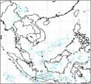
Maps for tracking path and strength of tropical storms in Indian Ocean
Provided by University College London

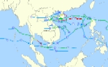
Maps for tracking path and strength of tropical storms in western region of North Pacific
By University College London

Archive data of storm paths and strengths
Total storms in (Explanation)
2012, 2011, 2010, 2009, 2008, 2007, 2006, 2005, 2004, 2003, 2002, 2001, 2000
Provided by University of Hawaii,Weather Underground, Inc.

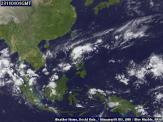
Latest image from satellite MTSAT-2 (Explanation)

Watch animation of the last 24-hour images Mpeg
Provided by
Kochi University

Weather maps at 0.6-km and 1.5-km altitudes (Explanation)
By HAII

Map of vertical wind at 5-km altitude (Explanation)
By HAII